The Project
The main topic of the proposed research project is to use the ambient noise records for the study of the crustal structure, focusing on the geophysical/geotechnical structures of the uppermost crust, i.e. the geotechnical scale (several tens of meters to roughly one to two kilometers).
Ambient Noise Data Collection
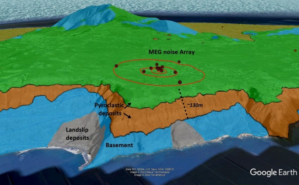
The first Working Package covers the setup and acquisition of ambient noise recordings, which will generate a set of test data for the processing, proposed in the next two Working Packages that will implement the two main objectives of the research project.
Joint ambient noise tomography

The use of ambient noise tomography methods using special seismic networks is based on the cross-correlation of noise records, mainly for the creation of dispersion curves for the surface waves propagating along the research area. The scattering curves contain information that allows the calculation of velocity spatial distribution (phase or group) of surface waves in the study area, through tomographic approaches. The final 3D geophysical model is typically obtained from the 1D inversion of the scattering curves, in a predefined tomographic grid. Specifically, the 1D inversion of the local dispersion curves provides the variation of the shear wave velocity (Vs) with depth for every node of the tomographic grid. Thus, local geophysical models of the subsurface structure are estimated, and the main discontinuity interfaces can be recognized. Although a significant number of works utilize ground noise tomography at different scales and geological environments, the limitations in the resolution of the method and the uncertainties that arise at several stages of data analysis and processing create significant problems of non-unique solutions and large errors.
One dimensional (1D) inversion of ambient noise data in selected locations of the area of Greece
The implementation of Work Package 3 (WP3) includes the processing of ground (environmental) noise measurements from a special noise array in order to find the best method for estimating the 1D structure expressed in terms of velocities of transverse waves (VS) with depth. First, the scattering curve will be computed from the ground noise data, using different computation methods, such as the HRFK method (Capon et al., 1969) and the WAVEDEC method (Maranò and Fäh, 2013). Then, different combinations of joint inversions, such as the scattering curve and the Rayleigh wave ellipticity, and the transfer function (where available) will be performed to estimate the 1D VS structure. Finally, the results of the 1D VS structures identified will be calibrated with the known geophysical/geological structures (where the structure is known from independent data) to find the best method that minimizes the errors and uncertainties of the estimated structure models.

Project Team

Papazachos Costas
Scientific Coordinator
Responsible for overseeing and coordinating both research and fieldwork of the project. In addition, he have research work in collection of micrordic data, in the one -dimensional micrordic data reversal in selected areas of the Greek area and research work in combination of micrordic data.

Chatzis Nikolaos
PHD candidate
Nikos is responsible for collecting soil noise data and installing seismic networks.

Anthymidis Marios
PhD
Marios is responsible for collecting soil noise data and installing seismic networks for the 3D and 1D identification of the geophysical structure of the subsoil.

Ravnalis Michalis
PHD candidate
Michalis is responsible for collecting soil noise data and installing seismic networks.

Kerkenou Athanasia
PHD candidate
Athanasia is responsible for collecting soil noise data and installing seismic networks.

Ventouzi Chrysanthi
PhD
Chryssa provides administrative, technical, and financial support, managing project finances and aiding in the preparation of technical reports. Additionally, she oversees the procurement and maintenance of seismological instruments and ensures the transfer and upkeep of all project equipment, while also providing any other required administrative, technical, or financial assistance.